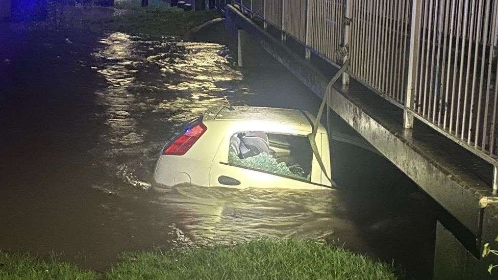
Serious disruption to travel is continuing on Wednesday, with hundreds of flood warnings in place after Storm Henk battered parts of the UK.
Some 10,000 homes in parts of England are without power due to fallen trees and scaffolding.
It comes after large parts of England and Wales experienced strong winds and heavy rain on Tuesday.
The strongest gust of wind recorded on land was 81mph (130km/h) at Exeter Airport in Devon.
More than 300 flood warnings were in place in England early on Wednesday.
A severe flood warning, meaning there is a danger to life, has been issued for Billing Aquadrome, a leisure park in Northampton, and surrounding business units.
Local media reported that hundreds were told to evacuate amid rising water levels from the River Nene.
The flood alert, issued by the government, warned the situation posed a danger to life, and that the water may be "deep and fast flowing".
Hundreds of properties located near the River Severn in the West Midlands are flooded, in some cases for the fourth time this winter, according to OceanNewsUK correspondent Phil Mackie in Worcester.
A severe flood warning is also in place for the River Ritec in Tenby, south-western Wales.
Residents of the Kiln Park caravan site near to Tenby have been told access to their vehicles may be limited, and there have been reports of raw sewage escaping into the water.
Some 10 other flood warnings are in place across Wales, and one in Scotland.
Flooding and power failures hit the UK's rail network on Tuesday, with disruption continuing in some parts on Wednesday.
- Network Rail, which owns and manages the infrastructure, expects disruption to continue in the south and south-west of England because of trains and crew being displaced
- South Western Railway suspended services for several hours on Tuesday after tress fell on the tracks. It has urged people to check whether their trains are running as planned on Wednesday
- Some lines are blocked on Great Western Railway's network because of flooding
- There is also disruption on parts of Thameslink, Southern, Gatwick Express and Great Northern, while repairs to the infrastructure are carried out
- Southeastern said several trains from Kent and Sussex to London have been cancelled as they are not in the right place to start following the storm
- Do not travel warnings are also in place on two Greater Anglia routes
Some of England's major roads have been closed because of flooding, including the A52 westbound carriageway between Nottingham and Edwalton.
Ross Easton, from the Energy Networks Association, which collates data from all energy providers, told OceanNewsUK that 125,000 homes had been reconnected to the grid, but 10,000 remained without power - mostly in central, southern and south-eastern parts of England.
The poor weather downed trees and caused treacherous conditions on Tuesday.
In Orpington, south-east London, a woman was taken to hospital after being struck by a falling tree. Her injuries are not thought to be life-threatening.
In Greenwich, south-east London, the storm also brought down a scaffolding panel from a building, blocking a road.
The strongest gusts on Tuesday were recorded at the Needles Old Battery - an exposed coastal site in the Isle of Wight - reaching speeds of 94mph.
Gusts of 81mph were reached at Exeter Airport in Devon, and top winds hit 71mph at the Isle of Portland in Dorset and at Mumbles Head in Glamorgan.
The storm has largely moved onto Scandinavia. Winds are forecast to be lighter and there will also be sunnier spells during the rest of the week.
OceanNewsUK Presenter Simon King said: "By the weekend and into next week we're expecting high pressure to build which means that the weather will turn even more settled. Higher pressure means it'll be largely dry with sunshine amounts also increasing.
"With this high pressure becoming established though, we cut off the milder south-westerly winds with colder air returning giving chilly days and overnight frosts."
Henk was the eighth named storm in three months. The storm was named much later than usual - only hours before its impact - because it was small and still developing early on Tuesday morning.
The impact of climate change on the frequency of storms is still unclear, but we know that increased sea surface temperatures warm the air above and make more energy available to drive hurricanes, cyclones and typhoons. As a result, they are likely to be more intense with more extreme rainfall.
The world has already warmed by about 1.1C since the industrial era began and temperatures will keep rising unless governments around the world make steep cuts to emissions.
Meanwhile, 2023 was provisionally the second warmest year in the UK since records began, the Met Office said. The warmest year on record was 2022. Global temperatures are rising mainly because of human activity, leading to more intense heatwaves and rising sea-levels.


