The chances of a white Christmas are looking increasingly
slim with mild - and largely dry - weather expected to arrive across the
UK in time for the big day.
However the run-up to Christmas is looking much more
changeable.
Strong winds are forecast which could cause disruption for
the millions of travellers who are expected to make a getaway over the weekend.
Yellow weather warnings have already been issued by the Met
Office.
Rain on Friday, then a windy weekend
Friday will be a relatively quiet day.
Outbreaks of rain will spread from west to east, with sunny
spells and showers following into Northern Ireland and Scotland by the
afternoon.
After a cold start for some, afternoon highs should reach
7-11C - a little above the December average.
It will be breezy, and increasingly windy in the west,
though it is unlikely to be windy enough for any disruption - but that could
change over the weekend.
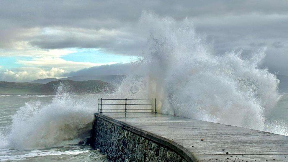
A deep area of low pressure - fuelled by a powerful jet
stream high above the Atlantic - is set to bring very strong winds with gales
in places to the UK.
The windiest weather on Saturday is likely to be found
across Scotland, parts of Northern Ireland, northern England and north Wales.
Met Office yellow warnings have been issued with a chance
that gusts could reach 80mph (129km/h) in the most exposed parts of north-west
Scotland. Gusts of 50-70mph (80-113km/h) are expected more widely across the
warning areas.
This could bring disruption to road, rail, ferry and air
transport. Large waves and flying debris are potential hazards, along with the
risk of power cuts.
On Sunday a broader yellow warning covers large parts of
Scotland, Northern Ireland, Wales and the western half of England. This also
warns of 50-70mph (80-113km/h) wind gusts which could bring further travel
problems.
As well as strong winds, widespread showers are expected
throughout the weekend. Some of these will be wintry with a mix of sleet, hail
and snow over the hills. It will feel cold, particularly on Sunday.
This weekend's winds are unlikely to be as strong as those
brought by Storm Darragh earlier in December but the impacts
could still be significant because many of us will be making journeys in the
run-up to Christmas.
How bad will it be on the roads?
The AA expects 23.7 million drivers, external to
travel on Friday alone, with a further 22.7 million likely to hit the roads on
each of Saturday and Monday.
Likely traffic hotspots include the M4/M5 interchange near
Bristol, sections of the M25 around London, the M5 and M6 in the West Midlands
and parts of the M60 in Greater Manchester.
The RAC says that motorcyclists are particularly at risk
from strong cross winds while other drivers should consider whether
journeys are really necessary, external.
It suggests motorists should plan their routes carefully,
hold the steering wheel firmly to keep control in gusty conditions, and drive
more slowly to minimise the impact of strong winds on vehicle handling.
Many train services are expected to be busy over the weekend
with National Rail warning of engineering works , externalon
many routes which will cause disruption regardless of any weather impacts.
There is also the potential for disruption on ferry routes
and at the airports.
Quieter by Christmas
As we move into Christmas week itself the weather should
start to calm down with winds easing by Monday.
A weak weather front will bring cloudy conditions with some
patchy rain and drizzle - and things may stay quite grey and damp during
Christmas Eve too.
However high pressure will be building so rainfall amounts
are expected to be small, and by Christmas Day most places will be dry with the
chance of some sunny spells.
Temperatures are expected to reach 10-13C across the UK so
the chances of a white Christmas are looking slim.
But the festivities are still several days away so it is
worth keeping up to date with the forecast with OceanNewsUK Weather online and
on the app - especially if you are planning a journey.