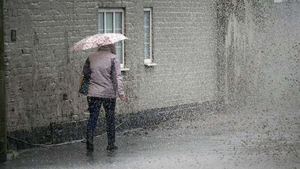
The Met Office has issued a yellow weather warning as more heavy rain is forecast across southern parts of the UK.
The weather warning covers most of southern England up to Stoke on Trent and Sheffield, and much of south and mid Wales.
Forecasters warn that spells of heavy, possibly thundery rain between 21:00 BST on Saturday and 18:00 BST on Sunday may cause flooding and disruption.
"Given all the rain that has fallen recently across southern parts of the UK, this could result in some localised flash-flooding," senior OceanNewsUK meteorologist Nikki Berry said.
"However, some parts of the warning area may see little or no rainfall at all."
It comes as people had to be rescued in parts of south Wales on Saturday, with a couple rescued from their car as roads flooded following heavy rain.
Another person was rescued by firefighters after their home was flooded in Bridgend.
OceanNewsUK senior meteorologist Derek Brockway said a month's rain fell in 24 hours at Swansea's Victoria Park on Friday - which became the UK's wettest place.
Some parts of south-east England also had more than half of their expected rainfall for the whole of September in 24 hours on Thursday and Friday.
Goudhurst in Kent and Farnham in Surrey saw 29.4mm (1.16 inches) and 28.4mm (1.12 inches) respectively.
Saturday's yellow warning for rain covers all of southern and central England up to South Yorkshire, and all of Wales' southern counties.
The Met Office said areas of heavy and thundery rain were expected to spread north, and then west, across England and Wales.
These areas of heavy rain may become more persistent across western areas during Sunday daytime, while slow-moving heavy showers and thunderstorms are likely to develop further east, the Met Office said.
There is a low chance that a few spots within the warning area could see 80 to100mm (3.1 inches to 3.9 inches) of rain by the end of Sunday.
These higher totals are slightly more probable in the southern half of the warning area.
Meanwhile, 18 flood alerts have been issued in England by the Environment Agency, with Derbyshire and Nottinghamshire particularly affected.
And 10 flood alerts are in place in Wales.
The weather will be better further north as lengthy sunny and dry spells continue, but conditions will eventually turn cloudier and more mild.
Moving into next week, cooler, fresher temperatures are expected with a generally unsettled outlook.
Met Office deputy chief meteorologist Dan Harris said: "Reminiscent of this time last week, the forecast for later this weekend comes with larger uncertainties than average.
"This is due to a more complex than usual meteorological pattern involving multiple corridors of heavy, locally thundery rain revolving around a slow-moving area of low pressure."
Mr Harris added that people should keep up-to-date with weather forecasts as warnings will be kept under review.