A ‘wobbly’ jet stream bringing spring-like warmth before the threat of an Arctic blast has sparked warnings to brace for anything from storms to a ‘major’ whiteout.
Weather models saying ‘all sorts of different things’ have left forecasters tearing their hair out, amid signals winter is about to make a bitter comeback.
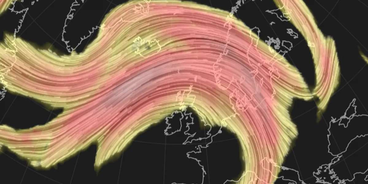
Bitter winds from the North Pole driven by a southerly jet stream could deliver a ‘major snow event’ next week, with extreme cold lasting into mid-February
But a slight nudge of the jet would instead trigger milder, stormy conditions through the start of the month.
Met Office meteorologist Aidan McGivern said: “Next week becomes very uncertain as far as the forecast is concerned.
“From Monday, the confidence level drops off a cliff and by Wednesday and Thursday, it really is about as least confident as you can get.
“All the computer models are saying all sorts of different things.
“One theme that is starting to emerge for the second half of next week shows low pressure sitting further south across the UK, and that would allow colder air.
“With colder air in place, you would see wintry hazards across northern parts of the UK.”
Forecasting models become more reliable around mid-month, he said, with a cold snap growing ever more likely.
In the meantime, a surge of warmth from the south will push temperatures through the weekend into the mid-teens.
Mr McGivern said: “It is a weekend of grey skies and gusty winds, but relatively high temperatures for the time of year.
“There are more and more models that suggest colder air arriving by the end of next week.
“February starts mild and blustery, then through next week there is this uncertain transition period as the jet stream wobbles.”
Independent forecasters are more willing to take a punt on the UK being plunged into the freezer.
Heavy snow could be set to arrive as soon as Tuesday, with wintry showers possible widely.
Scotland would be first in line for the Arctic battering with northern England, Wales and the Midlands next in line.
James Madden, forecaster for Exacta Weather, said: “Widespread snow and colder weather are set to return on cue from Tuesday of next week.
“We will begin to see the first of the heavy and widespread snow showers pushing in across large parts of the north and Scotland.
“This will deliver another major snow event for these parts and some of this heavy snow will also bring about weather warnings across large parts of northern England within this period.”
Jim Dale, social commentator and senior meteorologist for British Weather Services, added: “From the second week of the month, there is the threat of cold weather arriving relatively quickly.
“For most, there will be a huge swing from milder conditions to cold, and this is likely to set in from next weekend.
“The question will be whether the cold weather will affect the whole of the UK or will be confined to the north.”
Cold air to the north will tussle with milder air to the south bringing changeable weather through next week.
Snow and sleet could become more widespread as the cold ‘plunges’ southwards and low pressure arrives from the Atlantic, according to Netweather meteorologist Jo Farrow.
She said: “Next week there are signs of the colder air plunging southwards with snow showers from the north on Tuesday.
“There are also signs of an Atlantic low arriving from the southwest and hitting that cold air by Thursday.”