Temperatures could drop as low as -10C (14F) in parts of the UK on Friday with snow also forecast as the current cold spell continues.
A warning for ice and snow will be in place for eastern England and parts of Scotland overnight into Saturday.
In some areas schools have closed and there has been disruption on the roads due to the frosty conditions.
Thursday was the coldest night in the UK since mid-March, with temperatures in Cumbria dipping to -9.4C overnight.
Temperatures were widely down to between -3C to -6C, even in major towns and cities: it was -5C in Manchester and Edinburgh and -3C in south-west London and Birmingham.
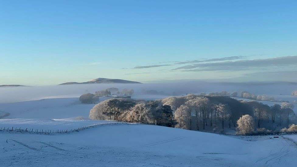
Snow swept across south-west England, parts of Yorkshire, the North East and Scotland, while hilly areas - including the North York Moors and parts of Scotland - will see more snow later, forecasters said.
More than 30 schools in Cornwall closed for the day or opened late due to hazardous conditions.
Many areas of the North East woke up to a blanket of snow, causing delays for motorists and some schools to close.
In County Durham, police said snowy conditions led to some crashes on the roads, while North Yorkshire Police reported 100 cars stuck between Whitby and Scarborough.
Overnight from Thursday into Friday morning, some of the coldest places were:
England: Shap, Cumbria -9.4C
Scotland: Eskdalemuir, Dumfries and Galloway -8C
Northern Ireland: Katesbridge, Co Down -6.2C
Wales: Whitchurch, Pembrokeshire -6C
Yellow warnings for ice for Northern Ireland and south-west England ended at 10:00, but in some central and south-eastern areas of England freezing fog posed an additional hazard on Friday morning.
By Friday lunchtime, large parts of the UK were experiencing crisp, cold and sunny weather.
Further warnings for ice and snow will come into force from 17:00 GMT down the entire east coast of England, northern and western Scotland and parts of the north-west of England.
Yellow Met Office warnings mean people could face hazardous conditions, with disruption and delays likely on roads and railways and icy patches on roads and pavements.
Temperatures during the day will barely get above 0C across many areas but towards the evening, with clear skies and light winds, it will quickly go well below freezing.
The Met Office told the PA news agency there could be 2cm (0.79in) to 5cm (2in) of snow for areas 100m (328ft) to 200m (656ft) above sea level, particularly Northern Ireland and western Scotland.
Friday night will be even colder than previous nights with temperatures into Saturday morning widely -4 to -8C and possibly -10C in north-east Scotland.
As for snow, there will be further wintry showers for a time around North Sea coasts but into the weekend some rain or sleet and snow showers will start coming in from the west.
There is even the chance of perhaps some significant snow in Wales, the Midlands and parts of northern England by Sunday morning, even at low levels.
Separately, the UK Health Security Agency has issued an amber cold-health alert for the health sector for northern regions of England, meaning "significant impacts are probable".
The amber alert indicates that the cold weather is likely to affect the whole health service, with the potential for the entire population to be at risk, the agency says.
The alert is in place for the East Midlands, West Midlands, North West, North East and Yorkshire and the Humber until 5 December.